-
 ×
- Start
- Kunstafdrukken ▸
- Artiesten ▸
- Categorieën ▸
- Kunststijlen ▸
- Fotolijst ▸
- Drukwerk ▸
- Alle drukmedia
- Canvas Leonardo (satijn)
- Canvas Salvador (mat)
- Canvas Raphael (mat)
- FineArt Photo mat
- FineArt Photo satin
- FineArt Photo baryte
- FineArt Photo glossy
- Aquarel Karton Munch
- Aquarel Karton Renoir
- Aquarel Karton Turner
- Aquarel Karton Dürer
- Natural Line Hemp
- Natural Line Rice
- Kozo White, 110g
- Kozo Natural, 110g
- Inbe White, 125g
- Unryu, 55g
- Bamboo, 110g
- Premio Unryu, 165g
- Murakumo Natural, 42g
- Bizan Natural, 300g
- Bizan White, 300g
- Aluminium composiet 3mm
- Plexiglas 5mm
- Bestel een set samples
- Welk printmedium past?
Linnen
Fotopapier
Aquarelkarton
Natural Line
Japans papier
Speciale media
Meer informatie
- Hulp & Service ▸
- Neem contact met ons op
- Verkoop je kunst
- Veelgestelde vragen
- Openstaande functies
- Klacht
- Voorbeelden bestellen
- Waardebonnen bestellen
- Verzendkosten
- Productietijd
- Duurzaamheid
- Beeldonderzoek
- Speciale verzoeken
- Wie zijn wij?
- Prijsbeleid
- Bedrijfsbeleid
- Kwaliteitsbelofte
- Onderscheidingen
- Spieraam
- Passe-partouts
- Decoratieve lijsten
- Beglazing
- Fillets
- Ophangsystemen
- Drukmedia
- Verzorgingstips
- Impressum
- Algemene Voorwaarden
- Gegevensbescherming
- Annulatierecht
Informatie & Service
Meer informatie
Wetenswaardigheden
Legale informatie
- Shop ▸
- Contact


 Bekijk in 3D / AR
 Toevoegen aan favorieten
 Kies achtergrondkleur
 Aanschouw het schilderij in een ruimte
.jpg "Tafel alfabetisch van de namen van steden, dorpen enz. die op de kaart van de Gelderse Hollanders staan, enz., door de heer Sanson")


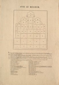


.jpg "Grondplan van de dertien markten in de stad New York, 1833")


.jpg "Høiderne af de hidtil maalte Bjerge")


.jpg "Geologie")
.jpg "Afstamming van de Europese vorstenhuizen van Keizer Ferdinand I of Koning Rudolf I van Habsburg")


.jpg "Plan van de Koninklijke Munt in de Toren, 1701")


.jpg "Rundvlees: diagram met de verschillende stukken vlees")

.jpg "Het schild van Achilles, naar de beschrijving in Homeros")


.jpg "„De man met zes hoofden”, karikatuur van Charles Maurice de Talleyrand-Périgord (1754-1838), 1815")


 - (MeisterDrucke-79146).jpg "Kaart van IJsland")
 - (MeisterDrucke-153535).jpg "Kaart van Cambridgeshire, gepubliceerd in Amsterdam ca. 1647-48")


 (detail from 330955) - (MeisterDrucke-41048).jpg "Madagaskar, uit een Atlas van de wereld in 33 kaarten, Venetië, 1 september 1553 (detail uit 330955)")
.jpg "Kaart van het Ottomaanse Rijk, uit de „Atlas Novus“")
.jpg "Kaart van Antwerpen, 1598")

 - (MeisterDrucke-85508).jpg "Kaart van Phillipsburg, uit")
 - (MeisterDrucke-137051).jpg "Kaart van Rhode Island, uit «Guerre de l")
.jpg "Kaart van de Slag bij Camperdown, uitgegeven door William Blackwood and Sons, Edinburgh en Londen, 1848")
.jpg "Loggans kaart van Oxford, westelijk blad, uit")


.jpg "De tuin van de kunstenaar in Vétheuil, 1880")


.jpg "De stad Troje vanaf zee, een illustratie uit Homeros")
.jpg "De Blauwe Grot op Capri")
.jpg "Christina")
.jpg "De tuin in Giverny, 1900")


 +43 4257 29415
 support@meisterdrucke.com
 Mo-Do: 7:00 - 16:00 | Fr: 7:00 - 13:00